Header Graphic
Apps for iPad

FAA Glossaries

Touring Machine Company

Designated Mountainous Areas

Flying on the West Coast, I am used to just about everywhere being considered mountainous except for portions of California’s Central Valley. I had a picture of the map in my mind, but couldn’t remember where I had seen it.

Designated Mountainous Areas

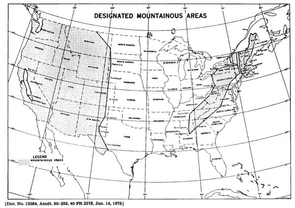
After a little digging, I found two sources:

CFR §95 Subpart B—Designated Mountainous Areas has a map that you can download.

The AIM 5−6−5. ADIZ Boundaries and Designated Mountainous Areas also has a map.

The MEA and MOCA on airways in mountainous areas provide 2,000′ of obstacle clearance while in non-mountainous areas they only provide 1,000′.

Leave a Reply


The content on this web site is provided for your information only and does not purport to provide or imply legal advice.
Should opinions, explanations, or discussions conflict with current FARs, other rules, regulations, or laws, then appropriate provisions of those rules, regulations, or laws prevail.
Navigation charts are provided for illustrative purposes only and are Not for Navigation.
TouringMachine.com is not responsible or liable for any errors, omissions, or incorrect information contained within this site.
Use at your own risk.
Copyright © 2002-2024 Touring Machine Company. All Rights Reserved.