
IFR for VFR pilots – around the pattern
If you listen to the tower and traffic at a local airport you’ll get a feel for the landmarks that the tower uses for incoming traffic. At SBP for example, traffic that is straight in is asked to report abeam the landfill. Sometimes it is phrased as “report four-mile final”. If you are in the vicinity of the airport, you know that traffic is on the centerline, a few hundred feet above the traffic pattern.
Traffic from the north most often flies over Cuesta Grade and is told to make a right downwind. Likewise traffic from the south usually reports over Avila and is told to report the left 45. Traffic from the west is usually told to report Laguna Lake and make a left downwind entry into the pattern.
But then there are the places you’ve never heard of—Hasby, Cadab, and Crepe aren’t local landmarks yet pilots often report flying over them. That’s because they are waypoints on an IFR approach. IFR pilots are required to fly six approaches in six months to remain current. The approaches don’t have to be in actual instrument conditions but can be under the hood. Since these are practice approaches, the actual wind conditions aren’t taken into account when flying them so you could find traffic in the opposite direction that you would expect, given the winds. Some approaches aren’t straight in and leave the pilot in a position where they have to circle to land.
The local flight school often has old charts around the flight simulator. You can download the National Aeronautical Charting Office approach charts from the AOPA web site or from the NACO AeroNav charts from the FAA website.
This is what the KSPB ILS chart looks like.
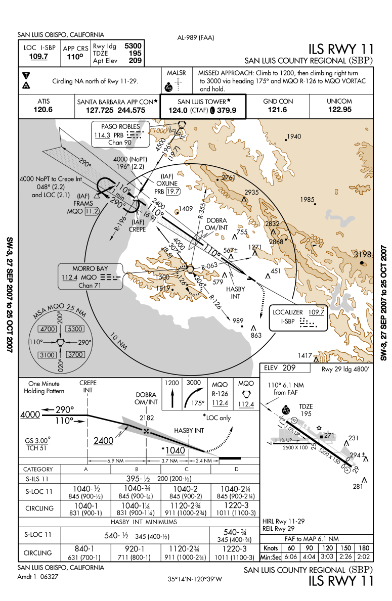
Look for the Initial Approach Fix (CREPE). On an ILS it is usually 10-12nm from the runway. The final approach fix (FAF) is usually 6nm from the runway. IN this case DOBRA is 6.1 nm from the end of the runway. Often there will be additional waypoints inside the FAF. If there is traffic at the airport, practice approaches are often told to break off the approach at HASBY. Now most ILS approaches have a 3 degree glide slope. For a light plane that usually means a descent of 500-600 fpm that will place the aircraft on the runway at the touchdown zone. If you are on a straight-out departure climbing at 500 fpm you are basically on the same path as the traffic on the ILS inbound. Knowing where the reporting points are can help you see and avoid the incoming traffic.
The RNAV approach is similar to the ILS. The initial approach segment doesn’t have to follow radio waves so it is often angled. The final approach segment is usually straight in to give the pilot time to get stabilized but the actual path is dictated by local geography.
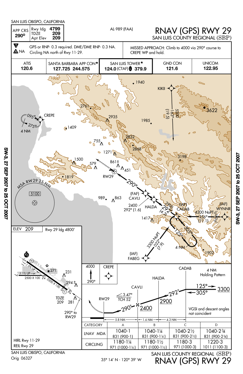
In this approach you’ll most often hear the pilot reporting at the IAF,CADAB, and sometimes also at CAVLI if there is traffic in the pattern. Note that at CAVLI the aircraft is at 2400 ft agl, 5.8 nm from the airport, and the glide slope that it should fly is 3.47 degrees. That’s slightly steeper than the VASI so you can expect them to be descending at about 600-700 fpm.
There are several variants on the procedures above but all of them involve an IAF, FAF, and prescribed altitudes. With a little work you’ll be able to spot aircraft that report using waypoints rather than compass directions.