These are the questions on the Sample Test and the answers that I found. The procedure that I used to find the answers was to put all of the relevant FAA publications in a folder and then search for words in the question or the correct answer. Since the FARs are regulatory and the AIM while not regulatory, provides information which reflects examples of operating techniques and procedures which may be re- quirements in other federal publications or regulations., if the answer appeared in either of those, I used it as the source. Next in order of priority were the Airplane Flying Handbook, and Pilots Handbook of Aeronautical Knowledge. There is a lot of information in these two publications that is also found word-for-word in the AIM.
For the most part, the FAA publications give the same answer no matter which source you choose, so it doesn’t matter if you study a more accessible publication rather than trying to wade through the AIM.
The ACS codes are matched with each question at the end of the Knowledge Test Guide so you can look up the answer in the appropriate FAA publication if you don’t like source for the answer I gave.
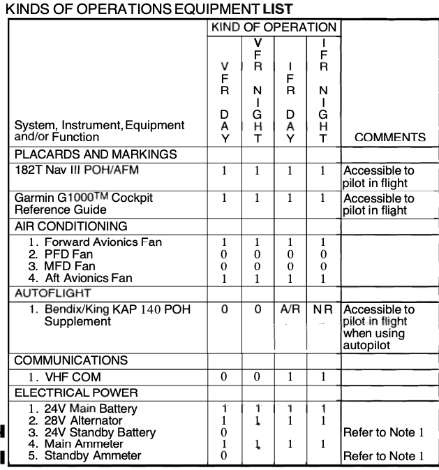
Some of the questions reference charts, tables, and images that are found in the Test Supplement Booklets.
I answered most of the questions based on my knowledge without looking things up or verifying them. They could be wrong, especially if there are “trick” questions that I missed. I’ll provide sources as time allows.
Preflight Preparation/Pilot Qualifications/Operating as pilot-in-command (PIC) as a commercial pilot:
1 . PLT442 CA.I.A.K1
You have accomplished 25 takeoffs and landings in multi-engine land airplanes in the previous 45 days. For a
flight you plan to conduct today, this meets the PIC recency of experience requirements to carry passengers in which airplanes?
A) Multi or single-engine land.
B) Single-enginelandairplane.
C) Multi-engine land airplane.
—C—
2 . PLT451 CA.I.A.K1
To act as PIC of a high performance airplane, which training or experience would meet the additional requirements.
A) Logged at least five hours as SIC in a high performance or turbine-powered airplane in the last 12 calendar months.
B) Received and logged ground and flight training in an airplane with retractable landing gear, flaps, and a controllable-pitch propeller.
C) Received and logged ground and flight training in a high performance airplane and received a logbook endorsement.
—B—
3 . PLT389 CA.I.A.K2
You are acting as a commercial pilot, but are not operating under the regulations of 14 CFR part 119. Which of these operations are you authorized to conduct?
A) On-demand, passenger carrying flights of nine persons or less.
B) Aerial application and aerial photography.
C) On-demand cargo flights.
—B—
4 . PLT448 CA.I.A.K2
As a commercial pilot, you decide to start a small business flying non-stop tours to look at Christmas lights during the holiday season. What authorizations, if any, are required to conduct Christmas light tours?
A) No authorizations or approvals are required if you hold the appropriate category and class rating for the aircraft that will be flown.
B) You must apply for and receive a Letter of Authorization from a Flight Standards District Office.
C) You must apply to the FAA to receive an exemption to carry passengers at night within a 50 mile radius of your departure airport.
—B—
Preflight Preparation/Airworthiness Requirements/Airworthiness requirements, including aircraft certificates:
1 . PLT377 CA.I.B.K1b
You are conducting your preflight of an aircraft and notice that the last inspection of the emergency locator transmitter was 11 calendar months ago. You may
A) depart if you get a special flight permit.
B) depart because the ELT is within the inspection requirements.
C) not depart until a new inspection is conducted.
—B—
2 . PLT377 CA.I.B.K1c
You are PIC of a flight and determine that the aircraft you planned to fly has an overdue Airworthiness Directive (AD). Which of the following is an appropriate decision?
A) No maintenance is available so you wait until after the trip to comply with the AD.
B) You make the flight because you can overfly an AD by 10hours.
C) You cancel the flight and have the aircraft scheduled for maintenance.
—C—
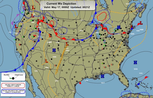
Preflight Preparation/Weather Information/Weather information for a flight under VFR:
1 . PLT059 CA.I.C.K2
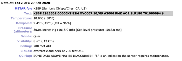
What is the thickness of the cloud layer given a field elevation of 1,500 feet MSL with tops of the overcast at 7,000 feet MSL?
METAR KHOB 151250Z 17006KT 4SM OVC010 13/11 A2998
A) 4,500 feet.
B) 6,500feet.
C) 5,500feet.
—A—
2 . PLT288 CA.I.C.K2
In the following METAR/TAF for HOU, what is the ceiling and visibility forecast on the 7th day of the month at 0600Z?
KHOU 061734Z 0618/0718 16014G22KT P6SM VCSH BKN018 BKN035 FM070100 17010KT P6SM BKN015 OVC025
FM070500 17008KT 4SM BR SCT008 OVC012
FM071000 18005KT 3SM BR OVC007
FM071500 23008KT 5SM BR VCSH SCT008 OVC015
A) Visibility 6 miles with a broken ceiling at 15,000 feet MSL.
B) 4 nautical miles of visibility and an overcast ceiling at 700 feet MSL.
C) 4 statute miles visibility and an overcast ceiling at 1,200 feet AGL.
—C—
3 . PLT061 CA.I.C.K2
What significant cloud coverage is reported by this pilot report?
KMOB UA/OV 15NW MOB 1340Z/SK 025 OVC 045/075 OVC 080/090 OVC
A) Three (3) separate overcast layers exist with bases at 2,500, 7,500 and 9,000 feet.
B) The top of the lower overcast is 2,500 feet; base and top of second overcast layer are 4,500 and 9,000 feet, respectively.
C) The base of the second overcast layer is 2,500 feet; top of second overcast layer is 7,500 feet; base of third layer is 9,000
feet.
—A—
4 . PLT445 CA.I.C.K3
You are pilot-in-command of a VFR flight that you think will be within the fuel range of your aircraft. As part of your preflight planning you must
A) be familiar with all instrument approaches at the destination airport.
B) list an alternate airport on the flight plan, and confirm adequate takeoff and landing performance at the destination airport.
C) obtain weather reports, forecasts, and fuel requirements for the flight.
—C—
5 . PLT206 CA.I.C.K3c
As air temperature increases, density altitude will
A) decrease.
B) increase.
C) remain the same.
—B—
6 . PLT511 CA.I.C.K3a
What are the characteristics of an unstable atmosphere?
A) A cool, dry air mass.
B) A warm, humid air mass.
C) Descending air in the northern hemisphere.
—None of he above are correct, but B is least wrong.—
7 . PLT495 CA.I.C.K3h
You are avoiding a thunderstorm that is in your flightpath. You are over 20 miles from the cell however, you are under the anvil of the cell. Is this a hazard?
A) No, you are at a safe distance from the cell.
B) Yes,hail can be discharged from the anvil.
C) Yes, this is still in the area of dissipation.
—B—
8 . PLT105 CA.I.C.K4
Which is true regarding the use of airborne weather-avoidance radar for the recognition of certain weather conditions?
A) The radar scope provides no assurance of avoiding instrument weather conditions.
B) The avoidance of hail is assured when flying between and just clear of the most intense echoes.
C) The clear area between intense echoes indicates that visual sighting of storms can be maintained when flying between the echoes.
—A—
Preflight Preparation/Cross-Country Flight Planning/Cross-country flights and VFR flight planning:
1 . PLT517 CA.I.D.K2
There is a high pressure system that is located south of your planned route in the Northern Hemisphere on a west to east cross-country flight. To take advantage of favorable winds, you would plan your route
A) on the north side of the high pressure area.
B) on the south side of the high pressure area.
C) through the middle of the high pressure area.
—A—
2 . PLT012 CA.I.D.K3a
(Refer to FAA-CT-8080-1E, Figure 11.) What would be the approximate true airspeed and fuel consumption per hour at an altitude of 7,500 feet, using 52 percent power?
A) 103 MPH TAS, 6.3 GPH.
B) 105 MPH TAS, 6.2 GPH.
C) 105 MPH TAS, 6.6 GPH.
—B—
3 . PLT430 CA.I.D.K2
According to 14 CFR part 91, at what minimum altitude may an airplane be operated unless necessary for takeoff and landing?
A) In congested areas, you must maintain 500 feet over obstacles, and no closer than 500 feet to any person, vessel, vehicle, or structure.
B) In uncongested areas, 1,000 feet over any obstacle within a horizontal radius of 2,000 feet.
C) An altitude allowing for an emergency landing without undue hazard, if a power unit fails.
—C—
Preflight Preparation/National Airspace System/National Airspace System (NAS) operating under VFR as a commercial pilot:
1 . PLT161 CA.I.E.K1
You would like to enter Class B airspace and contact the approach controller. The controller responds to your initial radio call with “N125HF standby.” May you enter the Class B airspace?
A) You must remain outside Class B airspace until controller gives you a specific clearance.
B) You may continue into the Class B airspace and wait for further instructions.
C) You may continue into the Class B airspace without a specific clearance, if the aircraft is ADS-B equipped.
—A—
2 . PLT163 CA.I.E.K1
(Refer to FAA-CT-8080-1E, Figure 52, Area 8). The traffic pattern altitude at the Auburn (AUN) airport is 1,000 feet AGL. May you practice landings under VFR when the AWOS is reporting a ground visibility of 2 miles?
A) Yes, you will be operating in a combination of Class E and G airspace.
B) No,the reported ground visibility must be at least 3 miles.
C) No,the Class E airspace extends to the airport surface.
—B—
3 . PLT161 CA.I.E.K1
(Refer to FAA-CT-8080-1E, Figure 53, Area 4.) You plan to depart on a day VFR flight from the Firebaugh (F34) airport. What is the floor of controlled airspace above this airport?
A) 1,200 feet above the airport.
B) 700 feet above the airport.
C) 1,500 feet above the airport.
—B—
4 . PLT370 CA.I.E.K1
(Refer to FAA-CT-8080-1E, Figure 52, Area 2.) When departing the RIO LINDA (L36) airport to the northwest at an altitude of 1,000 feet, AGL, you
A) must make contact with MC CLELLAN (MCC) control tower as soon as practical after takeoff.
B) are not required to contact any ATC facilities if you do not enter the Class C Airspace.
C) must make contact with the SACRAMENTO INTL (SMF) control tower immediately after takeoff.
—B—
5 . PLT163 CA.I.E.K1
Your VFR flight will be conducted above 10,000 MSL in Class E airspace. What is the minimum flight visibility?
A) 3NM.
B) 5SM.
C) 1SM.
—B—
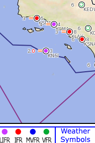
6 . PLT162 CA.I.E.K2
(Refer to FAA-CT-8080-1E, Figure 53, Area 2.) What is indicated by the star next to the “L” in the airport information box for the MADERA (MAE) airport north of area 2?
A) Special VFR is prohibited.
B) There is a rotating beacon at the field.
C) Lighting limitations exist.
—C—
7 . PLT376 CA.I.E.K3
What must a pilot do or be aware of when transitioning an Alert Area?
A) All pilots must contact the controlling agency to ensure aircraft separation.
B) Non-participating aircraft may transit the area as long as they operate in accordance with their waiver.
C) Beaware that the area may contain unusual aeronautical activity or high volume of pilot training.
—C—
8 . PLT376 CA.I.E.K3
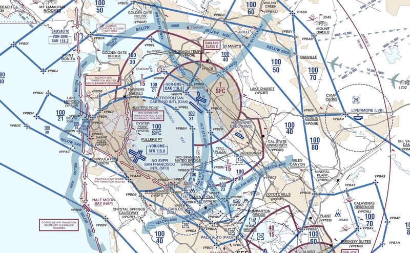
(Refer to FAA-CT-8080-1E, Figure 53.) You are planning a VFR west bound flight departing the FRESNO CHANDLER
EXECUTIVE (FCH) airport and you will be passing through the active Lemoore C and A MOAs. What action should you take?
A) Exercise extreme caution while in the boundaries of the MOA.
B) Avoid the MOA, VFR, and IFR flights are prohibited during daylight hours.
C) Contact the aircraft operating in the MOA on the Guard frequency of 121.5.
—A—
9 . PLT376 CA.I.E.K3
(Refer to FAA-CT-8080-1E, Figure 54, Area 3.) What is the significance of R-2531? This is a restricted area
A) for IFR aircraft.
B) where aircraft may never operate.
C) where often invisible hazards exist.
—C—
Preflight Preparation/Performance and Limitations/Operating an aircraft safely within the parameters of its performance capabilities and limitations:
1 . PLT011 CA.I.F.K1
(Refer to FAA-CT-8080-1E, Figure 32.) What is the total takeoff distance required to clear a 50-foot obstacle with the following
conditions.
Temperature: 50 °F Pressure altitude: 4,000 ft. Weight: 3,200 lb. Headwind: 15 kts.
A) 1,200 feet.
B) 880 feet.
C) 700 feet.
—B—
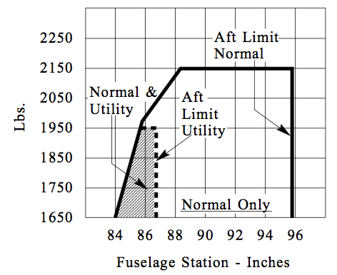
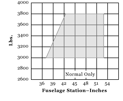
2 . PLT021 CA.I.F.K2f
(Refer to FAA-CT-8080-1E, Figure 38.) Given the following information, does the weight of the aircraft and center of gravity fall within allowable limits?
Empty weight (oil is included) = 1,275 lb.
Empty weight moment (in-lb./1,000) = 102.05
Pilot and copilot = 390 lb.
Rear seat passenger = 145 lb.
Cargo = 95 lb
Fuel = 35 gal
A) Yes, the weight and center of gravity is within allowable limits.
B) No,the weight exceeds the maximum allowable.
C) No,the weight is acceptable, but the center of gravity is aft of the allowable limits.
—A—
3 . PLT310 CA.I.F.K3
While executing a 60° level turn, your aircraft is at a load factor of 2.0. What does this mean?
A) The total load on the aircraft`s structure is two times its weight.
B) The load factor is over the load limit.
C) The gust factor is two times the total load limit.
—A—
4 . PLT123 CA.I.F.K3
What could be one result of exceeding critical Mach number?
A) Propeller stall.
B) Reduction in drag.
C) Aircraft control difficulties.
—C—
5 . PLT168 CA.I.F.K3
When transitioning from straight-and-level flight to a constant airspeed climb, the angle of attack and lift
A) are increased and remain at a higher lift-to-weight ratio to maintain the climb.
B) remain the same and maintain a steady state lift-to-weight ratio during the climb.
C) are momentarily increased and lift returns to a steady state during the climb.
—C—
6 . PLT113 CA.I.F.R2
Structural damage or failure is more likely to occur in smooth air at speeds above
A) VNO.
B) VA.
C) VNE.
—C—
Preflight Preparation/Operation of Systems/Safe operation of systems on the airplane provided for the flight test:
1 . PLT126 CA.I.G.K1d
When departing from a runway that is covered with snow or slush, what could a pilot do to prevent damage to the landing gear due to the conditions?
A) Do not retract the landing gear immediately to allow the gear to air-dry.
B) Immediately retract the landing gear so it can be heated in the gear wells.
C) Fly at a speed above the green arc of the airspeed indicator to remove the snow and slush.
—A—
2 . PLT343 CA.I.G.R1
Your aircraft has an exhaust manifold type heating system. The exhaust manifold is periodically inspected to avoid
A) carbon monoxide poisoning.
B) overheating in the cockpit.
C) extremely cold temperatures in the cabin.
—A—
Preflight Preparation/Human Factors/Personal health, flight physiology, aeromedical and human factors as it relates to safety of flight:
1 . PLT334 CA.I.H.K1d
You are most likely to experience somatogravic illusion during
A) a rapid descent.
B) deceleration upon landing.
C) rapid acceleration on takeoff.
—C—
2 . PLT463 CA.I.H.K2
You attended a party last night and you consumed several glasses of wine. You are planning to fly your aircraft
home and have been careful to make sure 8 hours have passed since your last alcoholic drink. You can make the flight now only if you are not under the influence of alcohol and your blood alcohol level is
A) below .04%.
B) below.08%.
C) 0.0%.
—A—
Preflight Procedures/Preflight Assessment/Preparing for safe flight:
1 . PLT281 CA.II.D.K1
You are preflight planning in the morning before an afternoon flight. Where would you find information regarding an “Airport surface hot spot?”
A) Call the Automated Flight Service Station.
B) In the Chart Supplements U.S.
C) In the NOTAM`s during your preflight briefing.
—B—
2 . PLT141 CA.II.D.K3
(Refer to FAA-CT-8080-1E, Figure 61.) Ground control has instructed you to taxi Alpha to Foxtrot to the active runway. According to the sign in the figure, which direction would you turn at this intersection to comply with ATC?
A) No turn is required.
B) The turn will be made to the right.
C) The turn will be made to the left.
—C—
Airport and Seaplane Base Operations /Communications and Light Signals/Normal and emergency radio communications and ATC light signals to conduct radio communications safely while operating the aircraft:
1 . PLT366 CA.III.A.K8
On a post flight inspection of your aircraft after an aborted takeoff due to an elevator malfunction, you find that the elevator control cable has broken. According to NTSB 830, you
A) must immediately notify the nearest NTSB office.
B) should notify the NTSB within 10 days.
C) must file a NASA report immediately.
—A—
Airport and Seaplane Base Operations/Traffic Patterns/Traffic patterns:
1 . PLT414 CA.III.B.K3
An airplane is converging with a helicopter. Which aircraft has the right-of-way?
A) The aircraft on the left.
B) The aircraft on the right.
C) The faster of the two aircraft.
—B—
Takeoffs, Landing and Go-arounds/Normal Takeoff and Climb/Normal takeoff, climb operations, and rejected takeoff procedures:
1 . PLT509 CA.IV.A.R2d
Your flight takes you in the path of a large aircraft. In order to avoid the vortices you should fly
A) at the same altitude as the large aircraft.
B) below the altitude of the large aircraft.
C) above the flight path of the large aircraft.
—C—
2 . PLT208 CA.IV.A.R3b
If you experience an engine failure in a single-engine aircraft after takeoff, you should
A) establish the proper glide attitude.
B) turn into the wind.
C) adjust the pitch to maintain VY.
—A—
Takeoffs, Landing and Go-arounds/Normal Approach and Landing/Normal approach and landing with emphasis on proper use and coordination of flight controls:
1 . PLT170 CA.IV.B.K2
What should be expected when making a downwind landing? The likelihood of
A) undershooting the intended landing spot and a faster airspeed at touchdown.
B) overshooting the intended landing spot and a faster groundspeed at touchdown.
C) undershooting the intended landing spot and a faster groundspeed at touchdown.
—B—
2 . PLT221 CA.IV.B.R3a
When conducting a go-around, the pilot must be aware that
A) radio communications are key to alerting other aircraft in the pattern that a go-around maneuver is being conducted.
B) the airplane is trimmed for a power-off condition, and application of takeoff power will cause the nose to rise rapidly.
C) flaps should be raised as quickly as possible to reduce drag and increase airspeed for a successful go-around.
—B—
3 . PLT140 CA.IV.B.R3b
What should you expect when you are told that LAHSO operations are in effect at your destination airport?
A) All aircraft must operate on an IFR clearance due to high traffic volume.
B) That ATC will give you a clearance to land and hold short of a specified point on the runway.
C) Delays due to low IFR conditions and high traffic volume.
—B—
Performance and Ground Reference Maneuvers/Steep Turns/Steep turns:
1 . PLT118 CA.V.A.K2e
To maintain a standard-rate turn as the airspeed decreases, the bank angle of the airplane will need to
A) decrease.
B) increase.
C) remain constant.
—B—
Navigation/Pilotage and Dead Reckoning/Pilotage and dead reckoning:
1 . PLT200 CA.VI.A.K1
What procedure could a pilot use to navigate under VFR from one point to another when ground references are not visible?
A) Dead reckoning.
B) Pilotage.
C) VFR is not allowed in these circumstances.
—A—
2 . PLT194 CA.VI.A.R1
When in the vicinity of a VOR which is being used for navigation on VFR flights, it is important to
A) make 90° left and right turns to scan for other traffic.
B) exercise sustained vigilance to avoid aircraft that may be converging on the VOR from other directions.
C) pass the VOR on the right side of the radial to allow room for aircraft flying in the opposite direction on the
same radial.
—B—
Navigation/Navigation Systems and Radar Services/Navigation systems and radar services:
1 . PLT354 CA.VI.B.K2
What is a consideration when using a hand-held GPS for VFR navigation?
A) Position accuracy may degrade without notification.
B) RAIM capability will be maintained for entire flight.
C) Waypoints will still be accurate even if database is not current.
—A—
Emergency Operations/Systems and Equipment Malfunctions/System and equipment malfunctions appropriate to the airplane provided for the practical test, and that the applicant is able to analyze malfunctions and take appropriate action for simulated emergencies:
1 . PLT337 CA.IX.C.K2d
You are flying an aircraft equipped with an electronic flight display and the air data computer fails. What instrument is affected?
A) ADS-B in capability.
B) Airspeed indicator.
C) Attitude indicator.
—B—